Where Am I Really? - GPS to Chart Corrections
by Cruising Editor on 8 Sep 2007
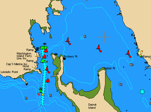
This chart looks perfect, is it perfect in its GPS positioning? SW
One of the most amusing – and of course potentially dangerous – aspects of using electronic charting is watching your boat sailing through rock walls, across protected breeding islands, through towns, to anchor on the nearest mountain. (See new readers's comment at end of article)
Cmap, or any other electronic charting system, is only as good as the original chart from which it was derived. The difference with electronic charting is that it can give you a false sense of security by the overlay of the boat image on the chart.
It is, however, possible to establish your own correction for charts that you find erroneous, as some charts that are internally accurate, having a consistent discrepancy throughout the chart. If you are able to establish this discrepancy, you can then apply it, and be confident of the ' new' GPS position being your correct position in relation to the chart.
HOWEVER, some charts do not have internal consistency, so you need to establish this in a few places on the chart before depending on your data.
What to do?
First, position your boat at a location that you can very accurately identify on the chart. This may be easiest at anchor and may require the use of multiple bearings.
Now note the position a indicated by your GPS and compare this with the latitude and longitude of your location as indicated on the chart. The difference between the two is the correction that should be applied to any GPS readings before they are plotted on the chart. Note that corrections are reversed if entering waypoints in your GPS whose latitude and longitude were derived from the chart.
With some GPS receivers is may be possible to enter this correction and let the little black box do the calculations. Your manual will indicate whether your GPS has this facility.
You will need to repeat this process several times in different parts of the chart before you can rely on the consistency of the correction.
It is a job well worth doing, particularly if you have a chart which you are constantly using.
This comment received from Australian reader Frank Walker:
I found the article interesting but you didn't mention ensuring that the chart datum on the gps was the same as for the chart. This is quite necessary on the NSW east coast as the datums vary a lot. On the beach at Coffs Harbour or in the marina can be affected by this alone. Similarly alongside the marina at CYCA(Cruising Yacht Club of Australia) or out in the bay is a chart datum exercise.
If you want to link to this article then please use this URL: www.sailworldcruising.com/37316