
PredictWind weather routing now with Depth Avoidance
by PredictWind 20 Nov 2021 06:26 UTC
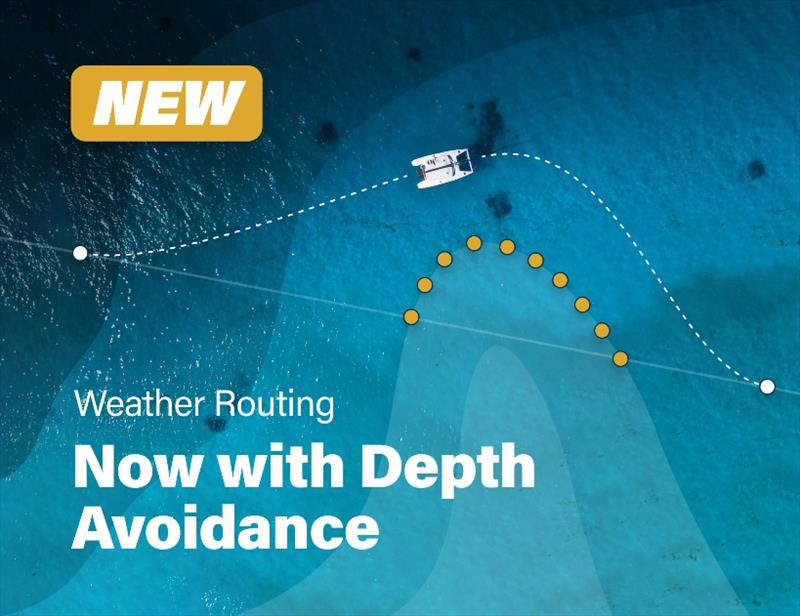
Depth Avoidance © Predictwind.com
In a world first for weather routing, the PredictWind Weather Router now uses Depth Avoidance, rather than traditional land avoidance. In order to achieve this, PredictWind acquired 2m/5m/10m/20m/30m depth contours for the entire world.
This massive depth contour dataset resides on the PredictWind servers, so that you can easily weather route your boat safely around shallow areas, using your selected depth contour.
Why is this important?
A weather router that goes across the land, or into shallow water renders the optimal route meaningless. The optimal route must be a route that your boat can actually follow in real life. For coastal routing this depth constraint is an essential feature, and often has a significant effect on the optimal route.
Are there any limitations of using Depth Avoidance?
The weather route should still be checked against navigational charts for rocks and other hazards. However in most cases the weather route will be safe for navigation.
Additional new features
- Move the start waypoint to your device's GPS position with a single click
- New user interface for the weather routing map display
- Boat Polars now displayed in polar plot to check your boat performance curve
- Boat Polars can be setup in the Offshore App
- Boat Polars can be imported/exported in various formats
- User Defined Boundaries now available in the Offshore App
- Port and starboard waypoints now available in the Offshore App
- Route comparison tool now available in the Offshore App
- Course import/export feature now available on desktop apps. Simply share the exported GPX file with friends/competitors, so they can add the same course to their PredictWind account
- All boundaries, saved courses and routing parameters are synchronised between the Offshore App and Website/PredictWind App
Key features of the weather router update
Accurate weather
Every PredictWind route is calculated using the highest resolution
ECMWF/SPIRE/UKMO/GFS/PWG/PWE forecast data. ECMWF is proven to be the most accurate global weather model from a National Weather Centre, however the Spire model actually beats the ECMWF forecast accuracy in offshore passages. The high resolution PredictWind models that are run at 1km/8km resolution are the highest resolution models available with proven accuracy in the short term. Getting 6 forecasts for every route gives you additional confidence in the forecast.
Speed and ease
As the PredictWind Weather Router is run on cloud computing off the boat, it is not essential to download GRIB files to calculate a route, and in some circumstances this will save you at least 50 MB of GRIB downloads. The PredictWind Weather Router has access to the highest resolution GRIB data for wind, wave and current. To download this data on a mobile or satellite connection is very slow and expensive. With the click of a button, the forecast information, including routes for all 6 forecasts are quickly and easily displayed to help make informed decisions.
Long range forecasts
We have added the ECMWF ensemble forecasts with an incredible long-range 4-week forecast. The ECMWF ensemble is unequivocally the leader in long range forecasting, and will let you plan your trip well in advance, with better accuracy than traditional climate forecasts.
Reliable
The PredictWind Weather Router simply works. No failed routes, or issues with the router crossing land or shallow water, so you can concentrate on sailing the boat, rather than troubleshooting why the router did not work. Check the technical report for the reliability of the new PredictWind Weather Router.