
A new era of hurricane observing and forecasting from NOAA and Saildrone in the Tropical Atlantic
by Saildrone 17 Dec 2021 14:02 UTC
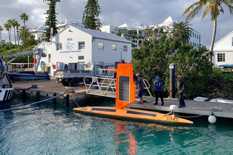
SD 1045 in port in Bermuda at the end of the 2021 Atlantic Hurricane Mission. Following Hurricane Sam, the vehicle was tasked to sail some 650 nautical miles north to Bermuda for retrieval © Ali Hochberg / Bermuda Institute of Ocean Sciences
The National Oceanic and Atmospheric Administration and Saildrone deployed five Saildrone Explorer uncrewed surface vehicles (USVs) to the Tropical Atlantic Ocean to gather data during the 2021 hurricane season.
The biggest challenge to hurricane forecasting is rapid intensification, which can have a huge impact if a storm intensifies just before landfall.
Hurricane track forecasting has steadily improved in recent years with data from satellites, buoys, and sensors dropped from aircraft flown into the developing storm. But improvements in hurricane intensity forecasting have been very slow. To understand how these large and destructive storms grow and intensify, scientists need to collect data about the surface fluxes—the exchanges of energy between the ocean and the atmosphere in the forms of heat and momentum.
Turn your sound ON and follow Saildrone Explorer SD 1045 through the eye of category 4 Hurricane Sam with this video. SD 1045 spent 24 hours inside the hurricane in winds over 90 mph and waves higher than 50 feet to collect important data about the exchange of energy between the ocean and the atmosphere.
In partnership with NOAA's Pacific Marine Environmental Laboratory and Atlantic Oceanographic and Meteorological Laboratory, the five USVs were equipped with specially designed "hurricane wings" to withstand major hurricane conditions—winds over 110 mph and waves over 50 feet. Saildrone hurricane wings are shorter and stronger than the typical tall, slender wings used in moderate to light conditions.
"The point of the whole scientific mission was to measure the surface flux within hurricanes, especially around the eyewall—and we got it!" said Chidong Zhang, director of the Ocean Climate Research Division at NOAA PMEL. "But before the mission began, my primary goal was to see if the new short-wing vehicle would work, because we just didn't know. I told everyone, 'If this vehicle can survive a hurricane, then this would be a big success story.' The whole mission exceeded my expectations."
There were two major breakthroughs in uncrewed systems during the 2021 Atlantic Hurricane Mission: acquiring data from the ocean's surface through the eyewall of a major hurricane and integrating two separate uncrewed campaigns (Saildrone USVs and underwater gliders) into a coordinated mission.
SD 1045 spent 24 hours inside Hurricane Sam collecting data from the edge through the eyewall of the category 4 storm, while continuously providing near real time data, images, and video of the storm via satellite. The vehicle survived sustained winds over 90 mph and waves well over 50 feet without a single sensor failure.
"If you look at the high-resolution pitch and roll data, SD 1045 was really getting tossed around. It slid broad-side down 80-foot waves and it went completely upside down a few times. It's not high wind speeds that cause a problem for the vehicle, it's the power of the waves," said Christian Meinig, director of Engineering Development at NOAA PMEL.
Hurricanes form when a weather disturbance, such as a thunderstorm, pulls in warm surface air from all directions and the ocean surface water temperature is at least 82 degreesF. The warm water gives the storm strength, and the rotation of the Earth makes it spin. As the storm builds, heat in the form of water vapor is transferred from the ocean to the atmosphere and strong winds mix the warm surface water with colder, deeper water to slightly cool the surface ocean.
However, scientists were watching the real time data from SD 1045 inside Hurricane Sam and noticed something surprising: The ocean wasn't cooling.
"I thought there was something wrong with one of the sensors, but that wasn't the case. There actually was no cooling. There was a lot of fresh water in that area, which added stability to the ocean and may have minimized the vertical mixing by the strong winds," explained Greg Foltz, a physical oceanographer at NOAA AOML.
?The fresh water impacting Hurricane Sam likely emanated from the Amazon River, which is the biggest river in the world in terms of outflow, discharging more than 55 million gallons of water per second into the Atlantic Ocean. This fresh water is carried by ocean currents north, right into the region where Hurricane Sam passed SD 1045. Salty water is denser, so it sinks beneath the fresh water from the Amazon, causing the ocean surface to be less salty.
"The low-salinity layer on the surface may have played a big role in keeping the surface of the ocean warm and allowing more evaporation of energy, fueling the hurricane. The role of salinity and lack of ocean cooling are two aspects that we'll be looking at as we analyze the high-resolution data in the coming months," said Foltz.
Along the track of Hurricane Sam, there happened to be a moored buoy that the storm passed over just six hours before SD 1045. Observations from the buoy were compared with those from SD 1045 and were found to agree very well, giving the team confidence that the saildrone's sensors were functioning correctly.
SD 1045 made history on September 30 when it sailed into and out of Hurricane Sam, joining the ranks of some of Saildrone's most famous USVs: SD 1020 circumnavigated Antarctica, SD 1021 became the first autonomous vehicle to sail across the Atlantic Ocean in both directions, and SD 1200, the first of Saildrone's Surveyor class, sailed to and from Hawaii along a never-before-mapped route.
In fact, all five vehicles in the 2021 mission contributed important insight into hurricane rapid intensification by sampling near other tropical storms—Fred, Grace, Henri, Mindy, and Peter.
SD 1031 sailed into Tropical Storm Henri, SD 1040 sailed into Tropical Depression Mindy, SD 1048 got into the strong winds of Tropical Storms Fred and Grace and SD 1060 was to the north of Tropical Storm Grace, and SD 1045 experienced the strong winds of Tropical Storm Peter before sailing into Hurricane Sam.
"During Henri and Grace, we flew the P3 Hurricane Hunter right above the saildrones and deployed dropsondes. These types of coordinated observations with different instruments allow us to better study hurricane intensity change," said Jun Zhang, a University of Miami CIMAS scientist in the Hurricane Research Division at NOAA AOML.
Henri later strengthened to a category 1 hurricane and made landfall near Westerly, RI, while Grace later rapidly intensified into a category 3 hurricane and was responsible for 13 deaths and more than $513 million in damages in the Caribbean and Mexico.
Saildrone Explorers are the only vehicles capable of collecting atmospheric, surface, and upper ocean data and videos inside a hurricane on broad temporal and spatial scales. The combination of real-time hurricane observations and videos of the air-sea interface had not been available from ocean surface vehicles until Saildrone and NOAA's successful 2021 mission. Hurricane conditions are far too dangerous and destructive for crewed ships, and atmospheric probes dropped from aircraft collect only atmospheric data and only at a single point. Saildrone USVs, powered exclusively with renewable energy, sail autonomously into and out of the hurricane with a zero operational carbon footprint.
The five saildrones were stationed in areas of the Tropical Atlantic where they had a high probability of intercepting a hurricane, based on historical data, but navigating a saildrone into a hurricane was no small feat. The NOAA team had to decide where the saildrone should be based on the storm's predicted track, and Saildrone Mission Control had to precisely task the vehicles toward the planned positions in light winds and strong currents.
Another type of coordinated sampling that took place was with subsurface gliders. The saildrones measure the air-sea interface and the gliders measure the upper ocean. Gliders are typically much slower than the saildrones, but at times, the surface currents were much stronger than the deeper currents, requiring a lot of work on the part of Saildrone Mission Control to sail the USV with the glider.
"The Saildrone pilots were really good at figuring out how to maneuver the saildrones with the gliders. We didn't have a glider with SD 1045 in Hurricane Sam, but that will be a goal for next year," said Foltz.
Since ocean temperature plays a key role in forming and fueling hurricanes, it naturally begs the question of how climate change is impacting these powerful storms. Foltz says that it's hard to attribute individual hurricanes to global warming, which happens over decades and centuries, but there is a pretty good scientific indication that warmer sea surface temperatures due to global warming are making stronger hurricanes even stronger.
"I like to look at it as [global warming is] increasing the maximum intensity that a hurricane can reach. It's not that every hurricane will increase in intensity, it's that under the right conditions, a hurricane that would normally reach a wind strength of 150 mph could reach 160 mph. It's creating the potential to have stronger storms," he said.
The success of the 2021 Saildrone mission has opened the door to future advancements in how the nation's top scientists observe the oceanic and atmospheric processes that lead to hurricanes. Subsequent missions will coordinate Saildrone USVs and underwater gliders with uncrewed aerial drones, providing unprecedented hurricane data from the upper ocean, ocean-atmosphere interface, and lower atmosphere. Saildrone USVs will also be paired or grouped to provide a multidimensional look inside a hurricane eyewall in each of its quadrants. The new observations will help improve hurricane forecasts, giving US agencies and coastal communities the information they need to better prepare for extreme weather—saving lives, protecting property, and minimizing economic impacts.
"From a purely scientific point of view, one saildrone in one hurricane, the data are still limited to really provide breakthrough results. But this mission has opened the door to a new era of how we study hurricanes. That's more important than the data themselves," said Chidong Zhang.
Read more: Inside the Eye of the Storm: Saildrone Collects Live Video of Category 4 Hurricane
Resources
- Aon, "Global Catastrophe Recap: August 2021," report, accessed December 14, 2021
- National Oceanic and Atmospheric Administration, "A World First: Ocean Drone Captures Video from Inside a Hurricane," noaa.gov, press release, September 30, 2021
- NOAA Atlantic Oceanographic and Meteorological Laboratory, "Ocean Drone Sails into Category 4 Hurricane Sam," blog post, October 6, 2021
- NOAA Pacific Marine Environmental Laboratory, "When Saildrone Met Hurricane Sam," blog post, October 4, 2021
- NOAA Pacific Marine Environmental Laboratory, "NOAA's 2021 Saildrone Observations of Atlantic Hurricanes for Improvement of Intensity Forecasts," webpage, accessed December 14, 2021
- NOAA Research, "Measuring Salt in the Ocean May Be Key to Predicting How Hurricanes Strengthen," article, December 16, 2021