
Reef assessment and mapping mission to the Central Pacific
by NOAA Fisheries 19 Mar 2023 00:09 UTC
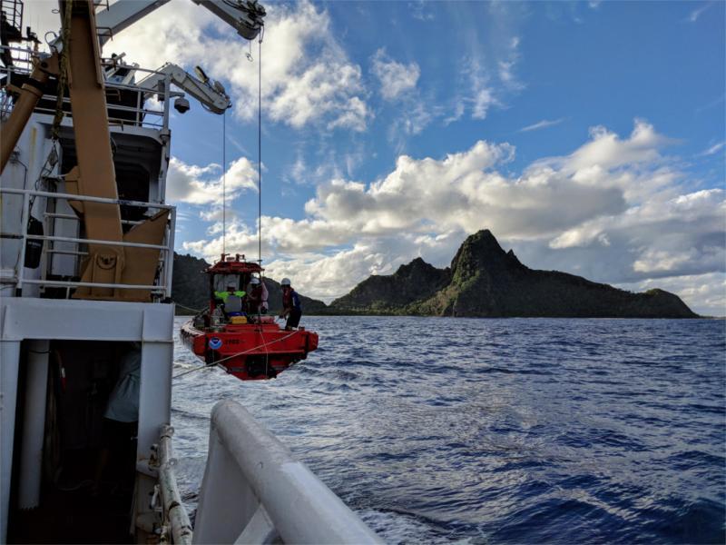
A NOAA ship launches a small survey boat during its last visit to American Samoa in 2018 © NOAA Fisheries / Evan Freel
Research surveys monitor coral reef ecosystems and assess impacts from threats including climate change, ocean acidification, disease, and land-based sources of pollution.
This year, NOAA scientists will conduct these surveys in American Samoa and the Pacific Remote Island Areas.
During expeditions this spring and summer, scientific divers will estimate the number of reef fish and measure corals around the islands. They will also collect thousands of photographs to create three-dimensional images of the reefs. The abundance and distribution of reef fish and coral reef organisms show us the conditions of the ecosystems. Over time, we can see how they have changed—an important part of reef conservation in the region. Researchers will also measure aspects of the environment to assess the status of ocean acidification and warming on coral reef health.
The team aboard the Rainier will also collect high resolution bathymetric data to update nautical charts, improve maritime safety, and characterize seabed habitat.
Island survey locations
American Samoa
- Tutuila
- Motu o Manu (Rose Atoll)
- Ta'u
- Ofu
- Olosega
- Swains Island
Pacific Remote Island Areas
- Palmyra Atoll
- Kingman Reef
- Jarvis
- Howland
- Baker
- Johnston Atoll
Coral reef assessment methods
Scientists will observe the number and size of reef fish and measure coral size and health. These ecosystems are packed full of a variety of plants and animals. They provide coastal protection, food, and livelihoods to millions of people worldwide, but threats to coral reefs and marine ecosystems are growing.
Scientists aboard the Rainier will also measure water temperature, salinity, carbonate chemistry, and other physical characteristics of the coral reef environment like coral growth and erosion. Using all these measurements, researchers can assess the potential early effects of ocean acidification on corals.
During this mission, scientists will also use a process called "structure-from-motion" photogrammetry to create three-dimensional models of the reef area surveyed by divers. Monitoring corals at the same locations over time will provide valuable information on their resilience to local and global threats.
National Coral Reef Monitoring Program
NOAA's National Coral Reef Monitoring Program provides funding and staff to investigate coral reef resources across the U.S. Pacific Islands, including American Samoa and the Pacific Remote Island Areas. This work complements long-term coral reef monitoring efforts of local agencies. You can follow our progress on our story map. It will have photographs from our mission and a map of where we will be diving and collecting information.
National Marine Sanctuary of American Samoa
In August, NOAA's National Marine Sanctuary of American Samoa will work with researchers from the Deep Coral Reef Ecosystem StudiesProgram: American Samoa. They will conduct deep-sea coral ecosystem surveys at the remote islands of Motu o Manu (Rose Atoll), Swains Island, and Ta'u. These coral ecosystems extend from 100 feet to more than 500 feet below the surface. They are a significant part of the coral reef ecosystem in American Samoa. Due to technological and safety constraints associated with these depths, only a handful of sites have ever been explored. The team is excited to shed light on these deep reefs and their relationship with shallower reefs. Updates will be posted on the sanctuary's social media.
Seafloor mapping using sonar
The Rainier will use an advanced multibeam sonar system to measure water depths over a large area. The result is a detailed "picture" of the seafloor. Cartographers will use the data to make nautical charts that scientists will use to study ocean physics and marine ecosystems. The Rainier also carries two 28-foot survey boats, each with its own multibeam sonar. These small boats can access areas that are too shallow or dangerous for the 231-foot-long ship. The process of mapping the seafloor is known collectively as "hydrography," and the Rainier is crewed by experts in the field.
Rainier data will be used to update nautical charting products which are crucial for safe navigation and scientific study of our ocean. It also supports the global initiative to map the entire ocean by 2030, known as "Seabed 2030." You can follow the mapping progress on this story map