
AI-Powered Navigation – iNav4u's Wayfinder is showing the way forward on the high seas
by Todd Robson/iNav4U 7 Feb 2023 03:26 UTC
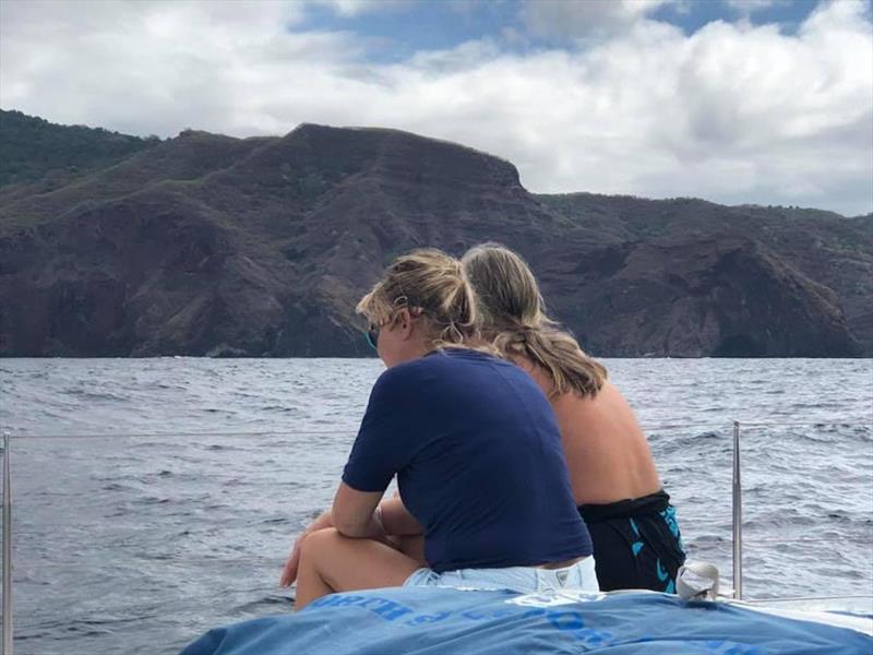
Brenda Robinson and Olivier Hendrikx off cruising around.. © iNav4U
It was in 2015 that Brenda Robinson found herself working as a crew member aboard a Lagoon 470 catamaran, sailing in French Polynesia. Recently retired after a long career running a company that developed enterprise software, Brenda decided her next mission in life was to take off and sail the world.
“I didn’t have a lot of experience as a crew member, but I did have a passion for the sea and travel,” says Brenda. “We did a lot of long-distance cruising, and I was always nervous on watch. Coming from a software background, I was frustrated with trying to set up things like alarms. Some of the interfaces on the instruments required you to think like an engineer and pull out a manual to figure out. The learning curve was steep and I was always nervous about ensuring the boat and our crew were safe.”
As fate would have it, that boat Robinson was crewing on was owned by Olivier Hendrikx.
Hendrikx, the president and founder of iNav4u, is a seasoned mariner who has been on boats for more than 50 years.
“I started sailing around 1972,” explains Olivier. “Until 1984, I sailed the North Sea, where I did some storm training in the winter with monohulls, the Mediterranean as a charter skipper on catamarans and most of the big lakes in Europe on a Libera Class regatta boat as a bowman. Sailing and navigation was always part of my life. I was 14 years old when I decided that one day, I would buy a sailboat and navigate the world.”
Fast forward to 2009 when Olivier acquired a 47-foot sail catamaran and started a 12-year full-time journey around the world.
“I sailed most of the passages alone, soon realizing that the available technology was not very helpful. Like most sailors, I had to deal with all the technological failures on board. When you go sailing, you dream about being in nature, enjoying the freedom to be there. The reality is that besides those rare days when everything is perfect, you are dealing with some issues on board.”
But there was one night in particular that motivated Hendrikx to create the Wayfinder technology.
“I left Cagliari in the south of Sardinia for a solo trip to Tunisia.” Hendrikx recalls. “The wind picked up as expected, and I enjoyed every bit of the journey. At around 11 p.m. the second night, I was getting ready to cross a hectic traffic lane. I had 18 cargo ships on my AIS screen. I was exhausted.
Meanwhile, the wind was over 30 knots, I already had two reefs in the main, and the question was should I take another reef and slow down or keep the speed to leave the crowded place quickly? My brain could not compute all the data like wind speed, closest point of approach to those cargo ships, and much more. It’s a simple challenge in daylight and easy conditions, but a stressful situation at night when you are tired. This was the first time I wished I had a screen turning red to tell me to take a reef and adjust my course to avoid a collision.”
But it was for a trip across Pacific when Hendrikx had planned a sail from Mexico to French Polynesia and had advertised for crew to help with the crossing. One of the young crew members happened to be a young German, Suell Mues who also happened to be an aeronautical engineer who specialized in human centric interfaces for flight systems.
He had even written a thesis on the subject. Not only did he help Hendrikx and Robinson with his expertise, but he also provided the team with all the current research on designing human centric interfaces for situational awareness.
It was with this wisdom, experience and perspective that led to the version of Wayfinder that is available today. Hendrikx designed it for the way people think and interact with technology.
The idea to simplify the interaction with boat technology was born.
About Wayfinder
Wayfinder is the cumulation of seven years of research and development. The entire team at iNav4u - from research through to development and quality assurance - are all highly experienced sailors. That, combined with the thoughts and ideas of many cruisers over the years, have allowed iNav4u to bring to market the world’s first smart marine technology built entirely by sailors for sailors.
Taking a page from the aviation industry where almost a century of research and development have all but mastered the transition from instruments to the flight systems you see on modern aircraft today, iNav4u has designed Wayfinder to be a human-centric system with situational awareness, and that is as easy to use as a new iPhone.
“Wayfinder makes suggestions before mistakes happen,” Olivier explains. “It keeps you aware of dangerous situations so you can learn without going through expensive and hazardous experiences. When you go sailing, you want to enjoy nature. Wayfinder keeps technology interactions to a minimum. That's the beauty of it: it is back to the basics, keep focused on your surroundings and your crew while staying aware of the situation.”
That same thoughtful approach applies to the hardware required to run the system. iNav4u’s high standard for robustness, ease of use and simplicity carries through to the hardware. Wayfinder is small but powerful, efficient, very easy to install and rugged in all weather extremes.
The hardware running Wayfinder is the same as what is being used on the Mars Rover, which has been running its mission on the red planet for the last 11 years. It has an expected lifetime of more than 200,000 hours or 22 years of operational time. A wide range of storage and operating temperatures make it perfect for worldwide sailing. It is lightning-proof, and with no moving parts like fans or mechanical hard disks, it is ideal for a harsh environment on rough seas. Rather than encouraging the user to replace hardware every few years on the promise of an upgrade and enhancement of features, the company started with the best and offers a lifetime warranty.
The system runs on an iPad or any monitor including a waterproof touchscreen developed by iNav4u. It is profile driven so it can be accessed by everyone onboard from their own devices with their own set of permissions and system preferences for viewing. There is no limit on the number of devices it can run on at one time. The system is built to work completely offline, but when it picks up an internet signal it is able to communicate, send SMS or email alerts from your boat while you are onshore. When it detects an internet connection, Wayfinder can automatically send updates and new versions without any intervention on the part of a person. It can backup your settings and data to the cloud, receive new tidal and weather data and be available for the customer support team to access for troubleshooting should an issue arise.
Simple design with safety being the top priority.
Here is a demonstration of Wayfinder by Iain and Brioni Cameron of Red Seas
Wayfinder has been designed for the people that interact with it, similar to what Apple did for the computing world. Great technology should be simple, proactive, error free, and provide information which gives you options to make quick informed decisions, leaving you with the ability to focus on what needs doing right now.
It is estimated that 96 per-cent of all boating accidents are due to human error. Having a system onboard to reduce those odds just makes sense. No more standing and staring at instruments trying to think when you are stressed or busy with something else. If there is no colour, no notification, no sound or no voice prompt, there is no problem.
At the heart of iNav4u is a passion for safety at sea and mission to delight its customers. And for the last year, Iain and Brioni Cameron from the YouTube channel Sailing Red Seas have had Wayfinder on their catamaran – testing it, challenging it and helping Olivier and his team at iNav4u perfect this technology that may be a game changer in the boating and sailing industry.
“From the moment you open Wayfinder, it’s like you have entered the space age and everything you have known until now is cave paintings,” says Iain Cameron. “We have used Raymarine Axiom, various Garmin plotters and spent a fair bit of time in front of the B&G Vulcan. All of which have a rich history in developing technology that can be used on a sail boat.”
Unfortunately this also means they have all taken a similar path.
Cameron also adds, “The goal has been to display sensor data to the user, usually in the form of an imitation analogue gauge or an 8 segment numerical value. While the latest models all boast high resolution displays, their interfaces still resemble something from the early nineties. Wayfinder’s approach is more human centred with the goal being to remove the user's need to ’translate’ data but rather simply display what that data means. When the wind speed picks up, you can see that value right there in the Primary Navigation Display but the system will also let you know if that means you should consider reefing. When you are coming into anchor and start mentally calculating the chain required to achieve a given scope, Wayfinder not only knows how much chain you have in the locker, it shows you what scope you can achieve based on your depth, bridle and freeboard. These are all calculations that you would normally make based on a single depth below keel reference and prior knowledge of your vessel.”
The Camerons sail a 2005 Leopard 47 and most of the instruments date back to the day she splashed. On board they have Raymarine ST60 instruments (individual displays for depth/speed, wind direction and autopilot). They also have a chart plotter which rarely gets turned on, as they rely on an iPad for up-to-date charts.
“Life before Wayfinder was always a frustration,” adds Brioni Cameron. “Making sailing-related decisions often required both of us to discuss the changing conditions and come to a conclusion of what actions to take. Simply taking a reef could require a debate while we stared at the wind gauge trying to calculate an average wind speed. There was a real sense that, even though many of the instruments were connected with SeaTalk1, they were not really talking to each other. Now with Wayfinder onboard, it is like have a third crew member who is constantly on watch and tapping us on the shoulder when we miss something important. It’s not that we are less alert to our surroundings or reliant on the platform but that we can be sure we haven’t missed anything when Wayfinder has nothing to report.”
The Camerons also rave that having all of their instruments available at the helm and on iPads around the boat means that when they are not on watch, the couple can still keep track of conditions and make handovers faster and easier than ever. With the automated logbook, they no longer miss the key moments in their passages as the system notes these, as well as tracking engine hours, sail changes and more.
“I always feel the best way to highlight how good Wayfinder is to point out that we haven’t taken our instrument covers off in over a year,” adds Brioni. “Everything we need and want is right there in one interface that we can carry anywhere onboard.”
How does Wayfinder work?
Go HERE to see the weekly updates with tutorials on Wayfinder
Where to find Wayfinder
Wayfinder is affordable at just USD1680 and has an optional iNav4uCare annual subscription fee of USD360.
The iNav4uCare package includes a lifetime warranty on the hardware, cloud connection for SMS, email and automatic backups, all new upgrades and new versions as they come along, free regional tidal and weather updates, customer support and access to the development team to send your enhancement ideas.
Wayfinder is available to pre-order at iNav4u.com. The company expects to begin shipping in March 2023.