UN's World Meteorological Organization warns of looming record temperatures
by Daria Blackwell 19 May 2023 21:48 UTC

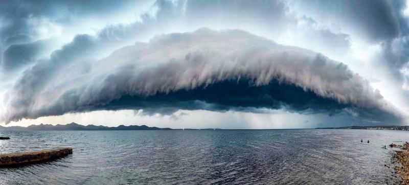
A shelf cloud in Zadar, Croatia © WMO / Šime Barešic
The development of an El Niño climate pattern in the Pacific Ocean this year is likely, with dangerously high temperatures and extreme weather events expected.
A looming El Niño could prompt a spike in global temperatures, the UN agency warned. An El Niño climate pattern will likely develop later this year, an event that could exacerbate global warming and break temperature records around the world, forecasters from the World Meteorological Organization said last week.
For three years, the opposite of El Niño - the cooling La Niña weather pattern - has been dominant in the Pacific Ocean. This has kept global temperatures from rising as quickly - but 2023 will see the return of the warmer counterpart.
El Niño and La Niña are natural phenomena that the WMO describes as "major drivers of the Earth's climate system". After a three-year La Niña spell, which is associated with ocean cooling, the world faces an 80 percent chance of an El Niño event developing between July and September. Tell-tale signs are an alarming spike in the warming of the ocean surface in the central and eastern tropical Pacific Ocean. With a slightly lesser likelihood, El Niño may develop even earlier.
WMO Secretary-General Professor Petteri Taalas highlighted that, according to the agency's State of the Global Climate reports, the eight years from 2015 to 2022 were the warmest on record. This was even though for three of those years, "we had a cooling La Niña and this acted as a temporary brake on global temperature increase".
According to scientists from NOAA's National Centers for Environmental Information, so far, 2023 stands out for the remarkable warmth that covered many parts of the U.S., with some states seeing their warmest January-April period on record. The first four months of the year have also been marked by seven separate billion-dollar disasters that have struck the nation: Five severe weather events, a Northeastern winter storm/cold wave, and a California flooding event.
Meanwhile, the massive bloom of Sargassum in the North Atlantic threatens the coastlines of Caribbean islands, Florida, and the Gulf of Mexico. NOAA scientists think that the arrival of large amounts of Sargassum in the tropical Atlantic was linked to an extreme climate event in 2009-2010, a strong, persistent shift of the North Atlantic Oscillation into its negative phase. While such occurrences were not completely unheard of, the size and frequency of Sargassum landings on Caribbean and U.S. beaches exploded in 2011.
Sargassum is beneficial in normal amounts in the Sargasso Sea, acting like floating islands that provide shade, food, and protection from predators, as well as breeding habitat for hundreds of different species of marine life, such as sea turtles. But this is not the normal Sargasso Sea. The Great Atlantic Sargassum Belt, as it is now known, stretches some 5,000 miles and contains 13 tons of seaweed. It can foul propellers, watermakers and engine intakes. Onshore, the seaweed can foul beaches, impair use of coastal waters, disrupt coastal ecosystems, inhibit tourism, and make a stinking mess as it decomposes. Sargassum can also contain high concentrations of heavy metals and arsenic. Removal is expensive.
There is some good news, however, El Niño years are associated with less chance of hurricanes in the Atlantic. Colorado State University Seasonal Hurricane Forecast indeed predicts fewer named storms and major hurricanes for the 2023 season. Unfortunately, El Niño years tend to be associated with higher-than-average cyclone activity in the Pacific.
A string of higher-than-expected temperatures this year is expected to produce serious difficulty for marine species. Some scientists are expecting a return of the warm blob, which can have dire consequences for coral and other marine inhabitants.
This article has been provided by the courtesy of the Ocean Cruising Club