Pocket Mariner launches nautical charts and navigation App
by Kevin Doel on 2 Jun 2013
Pocket Mariner launches Seanav SW
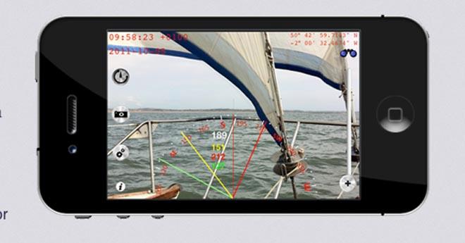
Now here's another one. Pocket Mariner, the company behind popular sailing apps such as Compass Eye and Boat Beacon, has launched SeaNav, a nautical charts and navigation App.
SeaNav lets you explore, plan and navigate your boating trips in real time and high-resolution using the latest Digital Vector Marine charts covering the US & Great Lakes or UK and Ireland.
Features of SeaNav include:
. Route Planning and real time tracking including Waypoints, SOG, COG, ETA, CTE etc.
. Route and Track export, import and sharing.
. Charts downloaded and stored on device so they work without mobile coverage!
. Seamless fast panning and zooming across charts.
. Live AIS Ship positions overlaid from Pocket Mariner's Boat Beacon app.
. Configurable layers; buoys, lights, depths, rocks, wrecks, anchorage areas etc.
. Automatic Chart updates.
SeaNav has two versions, SeaNav US which uses NOAA charts and provides complete coverage of USA and Great Lakes. SeaNav UK uses UKHO charts, and offers complete coverage for UK and Ireland.
Both versions are available for US$9.99 from the App Store on your iPhone or iPad.
For more information, visit www.pocketmariner.com.
Contact:
Kevin Doel
If you want to link to this article then please use this URL: www.sailworldcruising.com/110065