
Sailing in the Age of Gizmos: Part 2
by Jean Baillargeon, Bluewater Cruising Association 20 Nov 2018 12:19 UTC
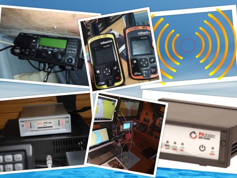
Communication devices © Bluewater Cruising Association
Last month, in part one of "Sailing in the Age of Gizmos" Jean shared information about the systems they have on Shamata, with a focus on communications.
In part two, Jean will continue to share information about communications systems, with a focus on weather and navigation aspects.
Predictwind and Iridium Go
To my mind, where the investment in an Iridium Go unit and monthly operating fee really pays off, if you get past the poor software design of the mail app, is when you start using the PredictWind app. PredictWind is essentially a weather app coupled with a routing app. So it is able to receive and display GRIB files (those weather data files that display wind speeds, air pressure and a bucket load more of info for the weather savvy). Given a few parameters to play with, the app can help devise a sailing route under those wind predictions. There are three levels of subscription to this service. We chose the middle one, the most advanced is really for folks out there racing their boats.
PredictWind uses four weather prognostic algorithms: two of their own design and the GFS and ECMWF models. The latter are weather models widely used by big agencies like NOAA and Environment Canada to help produce their forecasts. So you're getting the same data as the pros. The PredictWind app comes as part of the Iridium Web and Mail App package.
Although you have to subscribe to PredictWind to get the benefits of the middle option of services, the website offers well produced tutorials to help you make the best use of the app. One of the neat options PredictWind offers is deciding how you will receive their files. The download page shows five tabs at the top of the page. You can connect to PredictWind through the web, through Iridium or through regular email. If you choose to receive the files via email, PredictWind will ask which mail app you want to use to send the request for the files and eventually receive the requested files. You can choose your resident mail app or when offshore, the Iridium Mail and Web app.
Although you can download directly to the PredictWind app, the download page has to remain open the whole time the transfer occurs. That means while you cannot leave that page, otherwise the transfer is interrupted, you can't be doing other work on your device. File transfers for PredictWind can take between 5 -15 minutes, depending on the parameters set on routes and forecast ranges, which determine file size. We found an easier way was to select the email option for downloads. That avoids having to stay on the PredictWind page while transfers are ongoing and does not affect transfer times.
One added benefit is that when the GRIB files arrive for PredictWind in the Mail app you can open them with apps other than PredictWind, like LuckyGrib. When downloading directly to PredictWind the GRIBs will not be accessible to other apps.
What to download?
When I started using PredictWind, the route and GRIB downloads were taking hours to complete over my Iridium Go connection. I wrote to PW and asked why things were so slow. They explained that while offshore, some of the higher definition GRIBs – which I was requesting – are huge files and, while they provide great forecast accuracy in coastal cruising, when offshore this level of accuracy is not required. For regular GRIBs, PredictWind offers a choice of two resolutions: 100km or 50km. I use 50km.
Hundreds of miles at sea, there are few monitoring stations that can provide accurate weather data in sufficient quantity to help build forecasts close to the level of resolution demanded by high resolution GRIBs. By switching off that function, file size is greatly reduced and download times became manageable. The higher resolution GRIBs are only available for coastal areas, and only in some parts of the world where data is available. For example, sailing down the American west coast to Cabo San Lucas, those files can be accessed when high bandwidth is available. When in map view in PredictWind, with the high resolution GRIBs tab switched on, the map displays the areas of the world where that data is available.
GRIBs can provide more than just wind information. Air pressure, rain, convective available potential energy (CAPE) and gusts are all data you can add to a GRIB. The rain function is really neat because it shows areas of high convective activity, specially useful when crossing the ITCZ. The CAPE function measures the level of instability in the atmosphere and is a good predictor of unsettled weather. Each of these layers of information can be viewed separately under the map view in PredictWind or, if you downloaded the GRIBs in a GRIB viewer app, they can all be displayed and layered at once.
It is possible to request only routing information from PredictWind and skip the GRIBs altogether. Simply marking on the map a departure and destination point, the result will be a download file about 6-10kb in size. You won't get the cool looking GRIBs displayed around your route in the map view, but the numerical wind data will still be available under the "tables" tab in the app. Your possible routes will be displayed in the map view.
Are GRIBs enough of a forecasting tool?
GRIBs are great because they give you a graphical representation of the behaviour of winds over time. But they lack a few key essentials for nonprofessional weather forecasters. Basically, they are uninterpreted data. So how do you get access to that interpretation? There are a few simple ways of doing this. One is the NOAA ftp site, where you send a set of commands and the NOAA server sends back the appropriate files, mainly graphical area analysis and forecasts. The list of the these NOAA products is long and not exhaustive and it can take a bit of research to gather the ones needed for the area required.
Then there's Saildocs, a free service that operates the same way as NOAA and sends requested forecasts in text form, gathered from various national meteorological offices (New Zealand, French Polynesia, Fiji, as well as from NOAA). With these text and graphical forecasts in hand, one can be well-equipped to assess weather trends and make passage decisions. The next level of interpretation comes from hiring a professional weather router or routing service. There are many out there with the knowledge to help you make safe passage decisions. These can be particularly useful for longer passages when forecasting can become more difficult.
A few more weather bits
LuckyGrib is a neat GRIB file reader that allows layering of all kinds of information contained in GRIB files. Two ways of using it include in combination with PredictWind and, when connected to the internet, to directly download GRIBs showing fronts and pressure centres. LuckyGrib allows access to GRIBs with some weather interpretation added, not just raw data.
Buoyweather is another service that is great, but can only be accessed on the internet. It is a basic weather forecasting app providing information using your geolocation.
Windy is an app from the windy.ty site. It provides wonderful graphical representation of real time wind data as well as 500mb pressure fields and rain accumulation (a great way to keep track of the ITCZ). However, it only works while on-line.
HF Fax is a cool app for those who, while still wanting to use SSB, do not want the bother or the expense of a Pactor modem. HF Fax simply records the sound of the fax transmission right off the radio speaker – or headset or minijack – and reproduces the graphical area broadcast. Buying a short audio cable with mini jacks will allow most tablets or computers to record the audio from a line level (headset) audio radio output. One downside is the fax transmission squeals while recording.
Barometer Plus is a final app to keep track of pressure trends; a great indicator of incoming weather. Unlike a regular barometer, this app shows pressure trends over hours, days, weeks, or longer. It requires a tablet with a barometer sensor. Some IPad Pros offer this option.
Electronic navigation
Now that GPS is an integral part of our lives, the marketplace is ripe with digital navigation products, I made the choice of redundancy early on and started collecting different apps and seeing how they were suited or not to my navigation needs. We use a RayMarine C-95 chart plotter with Navionics charts. Our IPad runs INavX, using Navionics charts, and Ovitalmap, a Google Earth overlay charting tablet app. I find the IPad easier for passage planning with INavX. It's great to access navigation information when you're away from the binnacle and the chart plotter. It is also good for back-up should the chart plotter die.
Since we have a laptop, I then found an app that could run a free navigation program called OpenCPN. This software has been around for a while, is free and programmers are continually updating it. I use it as a back up for electronic navigation. It can use the free NOAA charts and, if run under Windows, you can overlay Google Earth maps. This process is well described on the OpenCPN site. It requires a GPS USB receiver connected to a laptop and offers extremely accurate fixes, complete with the level of detail only Google Earth can provide. In places in the world where traditional charts are sometimes way off, using Google Earth overlays is much more accurate.
In order to use the Google Earth overlays, the underlying files that compose the Google Earth display, called KAP files, have to be loaded onto your device. One way to do this is, while on-line, to manually select the areas of interest. It is important to adjust the zoom level on Google Earth to provide enough useful detail to navigate safely. This process can be time consuming when trying to cover huge areas. It is also possible to share with other sailors KAP files stored on a hard-drive.
A final level of redundancy are paper charts, especially as a lightning strike could disable all the electronics on board. Besides, paper charts are great for passage planning.
Useful bits
AIS has made cruising a lot safer in the last few years. The ability to "see" other vessels, their tracks, closest points of approach (CPA) and a few other boat details, has made collision avoidance a lot easier. Nothing replaces good traffic watching practices on board as not all vessels have AIS transceivers, but the ease of identifying traffic provided by AIS certainly adds to safety.
We opted for an AIS transceiver – both receiving signals form others and putting out our own for the world to see – the price difference between a receive-only unit and a transceiver is negligible. We did not add a separate VHF antenna for the AIS transceiver, but simply use a signal splitter to the one VHF antenna, where both our VHF radio and the AIS share the antenna. The radio is given priority over the AIS in case of conflict.
AIS capable VHF radios are also available, making it unnecessary for an additional AIS unit. However, it is unclear if these all-in-one radios are recieve-only.
Wifi booster
This last piece of electronics, a wifi booster, is nice to have on board. While there are all-inclusive units available, we bought the Groove 2 antenna that has a built-in router and connects to a home device wifi router to create the local network on the boat. However, access from the boat to an accessible on-shore internet network is rare. Most times, you end up at a café and, for the price of a cup of tea or a drink, you can browse to your heart's content. In some countries, like French Polynesia where phone service and data services are separate, purchasing a local SIM card and a few hours worth of data works is simpler.
Last thoughts
For us, getting ourselves and the boat ready was a matter of 4-5 years. From the time we bought the boat to the time we left, we were faced with many choices. Many of which turned out to be useful additions to our cruising life. I enjoy technology and I thrive on getting things to work and accessing information. I enjoy that cruising allows me to gain a better understanding of these systems, of the information they provide and of how to use them efficiently to make our cruising more enjoyable. This might not be for everyone. Some cruisers prefer a simpler way to go about their travels and there is nothing wrong with that approach. In fact, a reduced reliance on technology may lead to fewer system failures. Given the amazing array of technical possibilities that exist for cruisers, I feel I would be missing out on the opportunity to "augmented" my experience with the insights these technologies offer.
This article has been provided by the courtesy of Bluewater Cruising Association.