
C-MAP Charts meet NavimetriX: Weather, routing and charts on every screen on board
by C-MAP 10 Nov 08:10 UTC
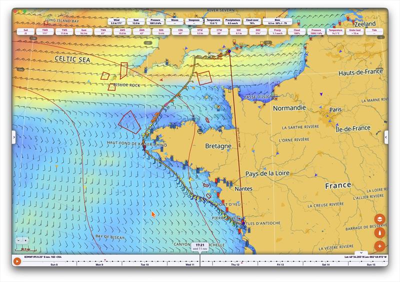
Soft4Sail and C-MAP join forces to put the world's leading marine charts at the heart of NavimetriX, on iPhone, iPad, Android, Mac, Windows and Linux © C-MAP
Soft4Sail and C-MAP®, a leader in digital marine cartography and cloud-based mapping, today announced the integration of C-MAP charts into NavimetriX.
For the first time, sailors can access cartography from C-MAP, live weather and weather routing in a single app, on all five major platforms at once. Available since October 28, just days before the start of the Route du Rhum on November 1, 2026, the integration enables sailors to plan and navigate both offshore races and cruising adventures using C-MAP charts within NavimetriX.
NavimetriX is the all-in-one navigation app for cruising and racing sailors. Everything a skipper needs, in one place:
- Weather: GRIB forecasts from the main global and regional models, wind, gusts, pressure, rain and more, played back on a timeline.
- Weather routing: optimal routes computed from the boat's polar and the forecast.
- Instruments: live NMEA® and AIS data from the boat's network, on configurable gauges.
- Logbook and sharing: every passage is recorded, and can be replayed or followed live by family, crew and followers from a simple link.
Now, with the addition of C-MAP, depths, navigation aids, harbours and hazards appear right under the routes, the forecasts and the AIS targets. No more switching between a chart app and a weather app: the whole picture is on one screen, on the phone at the helm, the tablet in the cockpit or the computer at the chart table.
"This is the app sailors have been asking us for: their weather, their routing and their vector charts, together, on every device on board. With C-MAP, NavimetriX delivers exactly that," said Olivier Bouyssou and Henri Laurent, founders of Soft4Sail. "Shipping it on five platforms, in time for the Route du Rhum, is a milestone for our team. We thank C-MAP for an outstanding partnership."
"NavimetriX has built a compelling experience around weather, routing and onboard connectivity," said Max Cecchini, Director of C-MAP. "By integrating C-MAP, sailors can now access trusted charting alongside those capabilities in a single application across every major platform. We're excited to partner with Soft4Sail to deliver a richer navigation experience to boaters worldwide."
Availability
NavimetriX with C-MAP charts is available now on:
- iPhone, iPad and Mac: Apple App Store
- Android: Google Play
- Windows and Linux: download from navimetrix.com